Even if the roaming charges in Europe are largely abolished, one does not always have a fast online connection to transfer maps to travel on the mobile phone or tablet. In the ex-european Auslaund can be because of the roaming charges in addition very expensive.
The solution is an offline map, which you can download to your mobile device before starting your journey and then use it free of charge at any time and place without any internet access. But who offers the best off-line map in his map app and the best land and road maps on the road?
Photo: Stack of maps and iPad
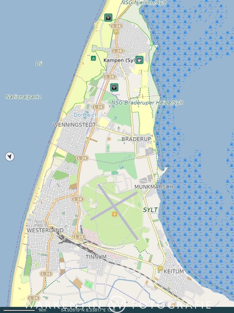
Since I have been connected to the Apple world for decades, I can of course only speak for iPhones and iPads. After I tried several map apps, my favorite offline maps is the map app “Pocket Earth”. The program has been developed by a small, dedicated team of travel friends and photographers, but only available for the iOS system. It allows you to download road maps and topographical maps of the entire world to your mobile device – at least if you have enough space available. Of course you can also download individual countries and for large countries individual states, regions or cities, in order not to burden the storage space unnecessarily.
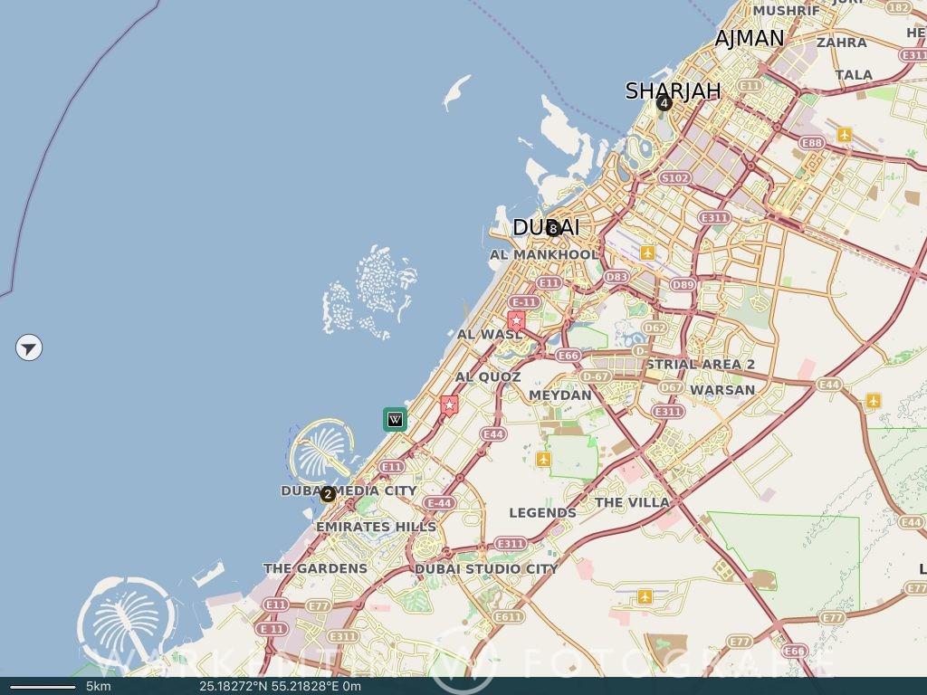
The map data are very accurate and contain, as already mentioned, unlike many other apps, even topographical data, so that you can see differences in height in the landscape very well. In addition, tourist highlights, many hotels, restaurants, petrol stations, banks and other important facilities are displayed. A simple route planner is on board as well as a search function and a GPS tracker, but I particularly like the possibility to place your own markings at every point of the earth and to provide you with own comments, which can be sorted in self-defined rubrics. In the course of time, a personal, private travel guide with special places, which you have discovered during your travels, emerges.
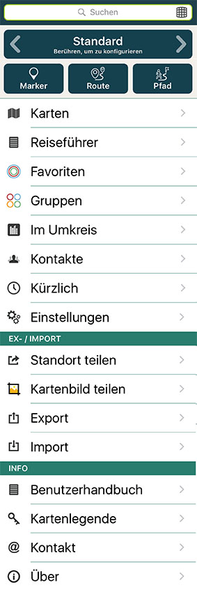
Other functions include; Wikipedia guide, which you can download and then also can use offline. There are also import and export functions for GPX data, own notes, etc. and a favorites list. The app’s functionality is complemented by round-trip search, route logging, route planner, and access to the contacts in the Contacts app to use in the maps and directions.
Conclusion
With PocketEarth, you save a lot of weight when you’re traveling with printed maps, and in many countries you pay a lot of fees for roaming data from online maps. The maps are comprehensive, accurate and updated regularly.
Downloads
 The Pocket Earth application is free of charge, for the complete package of the offline maps a charge of 9.99 € for the In-App purchase.
![]() Alternatively you can buy the app Pocket Earth PRO, the price of the app including all street maps is 4.99 €, the topographical maps can be purchased as an in-app purchase for a further 4.99 €.
Alternatively you can buy the app Pocket Earth PRO, the price of the app including all street maps is 4.99 €, the topographical maps can be purchased as an in-app purchase for a further 4.99 €.