We are seated, somewhat cramped, in the charter flight to Lanzarote and are in the landing approach. In a large arc, we circle the volcanic island at a few hundred meters high and the island of eternal spring is close at hand. And yet, before the first visitor sets his foot on Canary soil, this island polarizes its visitors forever. In the seat row behind me mumbles: “Look, the volcanoes. At last we are there! “, While a few rows in front of the anger at the chosen holiday destination is unmistakable:” Hey, have a look, there is nothing. Not even palm trees do they have!”.
And indeed, at first sight, the fourth largest island of the Canary archipelago, the Moroccan coast, offers hardly any charm worth a flight of over four hours. You have to take a closer look to discover the enchanting charms of this mysterious volcanic landscape. But those who make this effort are rewarded with plenty of money and always come back to Lanza, as their lovers call it short.
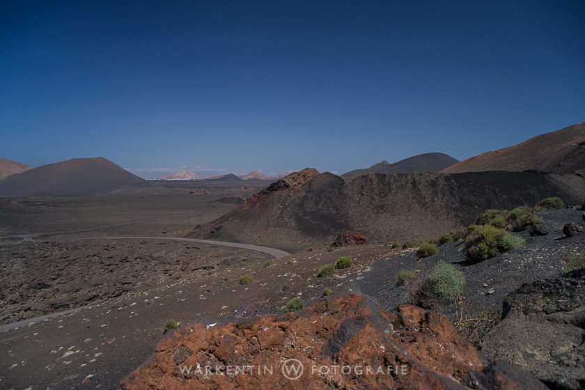
From the point of view of history, Lanzarote is a fairly young island with an age of about 15 million years. Although it is one of the oldest of the Canaries, much of its surface and landscape is still very young. Less than 200 years ago, the last volcanic activity took place, which radically altered about one third of the area of Lanzarotes. This makes it very interesting not only for many geologists and biologists, but also offers numerous photographers and filmproductions always fascinating scenes.
A good starting point for photographic excursions on the island is Playa Blanca, the southernmost place on the island. The actual tourist center of Puerto del Carmen is centrally located, but is only recommended for those who appreciate the shopping mile, disco and kebabs as well as the nearby noise in its immediate vicinity. The Costa Teguise is the place where the charm of a man-made tourist resort built on the right-hand side of a tear-slab, which does not really correspond to my concept of a Canary town, radiates its charm.
Even Playa Blanca is no longer the romantic fishing village that was not so long ago but the ongoing construction boom leads to the fact that the hotels, restaurants and shops spread quite large area so as not the narrowness and noise as they arise In Puerto del Carmen are common. In addition, many of the natural attractions in the south of the island are less cloudy and humid than in the north.
Who is on the island for two weeks, the first two days should take a bus tour. The “South Tour” and the “Nordtour” are offered by all tour operators, bus companies and hotels, so you can quickly get a good overview of the whole island. Only a warm sweater, if possible with a roll collar, should be taken, because the Spanish bus drivers are obviously very proud of the efficiency of their air conditioning!
Afterwards you can get a rental car for a little money at the company Cabrera Medina (See travel infos).
Timanfaya National Park
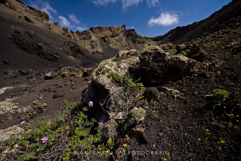
The first tour with your own car is of course in the volcanoes! The Timanfaya National Park can be crossed partly by your own car. There is a car park at the place where the camel rides start. It’s the only one. From there you can explore the terrain on foot, as long as you remain meticulously on the road. Never leave the road, never park at the edge of the road and forget the idea of moving within the national park area on non-expressly approved paths. The rangers of the park administration have their eyes everywhere, are relentless and do not discuss. Only in this way does the national park area remain in the pristine beauty in which it is. Fascinating photographs are also captured here, if one sticks to the strict rules.
Coming from the south via Yaiza, you pass the camel station on the left, follow the road, after a few turns you will come to the inner part of the park, which can only be visited by a bus of the park administration. There is also the famous restaurant, where the meat is grilled over volcanic residual heat and the obligatory souvenir shop. The bus tour is recommended and the landscape to be seen is very impressive. You can not get off during the entire tour, however, photos are only possible through the closed bus windows.
A little tip on the edge! Anyone who still has a sun visor made of soft rubber suitable for his lens, as they used to be, should take her on the bus tour. You can avoid reflections of the window panes by placing the sun visors directly on the glass, and the mobility of the rubber can still be used to freely determine the image detail.
Going north, you pass the visitor center on the northern national park border, an exhibition building with all sorts of knowledge about the park and volcanism in general, including an earthquake simulator!
The way back could lead via Tinajo and Mozaga through the wine-growing area La Geria. Here, too, you find yourself in an extensive volcanic site, the unusual technique of wine cultivation in conical bottoms is unique in the world and is under the protection of UNESCO. Here, too, there are countless photo-motifs – and several bodegas on the edge of the path invite you to the wine tasting.
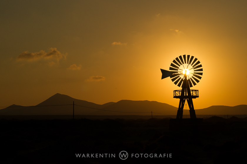
Praxistipp! As is the case all over the world, the more deeply the sun is, the better the images become. So early in the morning or in the evening you should go to take photos.
Western coast
A very interesting trip is also a trip along the west coast. From the roundabout in Playa Blanca take the new four-lane national road LZ 2, but follow the parallel road LZ 701. You can also reach it from the roundabout – one exit further. After a few kilometers you will find a small sign on the left, marked “Playa Janubio”, one of the legendary black beaches of Lanzarotes.
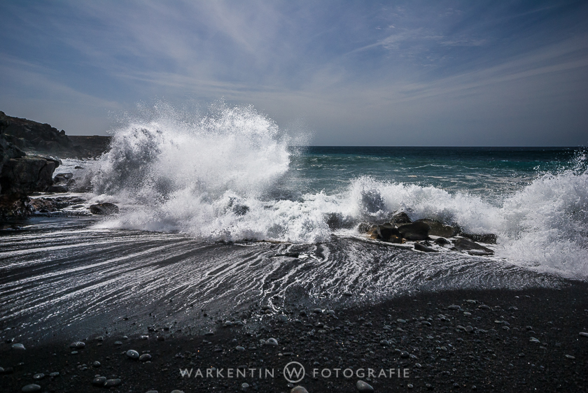
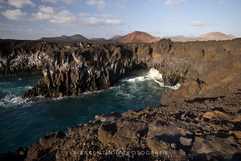
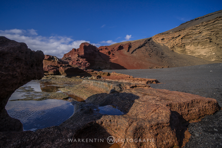
Little left behind is the large saline, in which the sea salt is won. If you follow the road to the salt marshes along the coast to the north and El Golfo, you will pass “Los Hervideros”. These are particularly impressive rock formations along the coast with an incomparable everlasting play of waves in the bizarre cliffs, rocky promontories and caves. But be careful, the sea is particularly moody and anyone who gets too close to the rough Atlantic for a particularly interesting perspective is not only rewarded with an extensive shower, but also gets a thorough cleaning with salt water for his camera! From “Los Hervideros” we hopefully continue with a dry camera towards El Golfo. The place is famous because of its green Lagunensees, the lake I find rather unspectacular, the surrounding steep coast landscape for the more impressive.
In the town of El Golfo there are several small fish restaurants, which offer just as good cuisine as a view.
Yaiza, Uga and Teguise
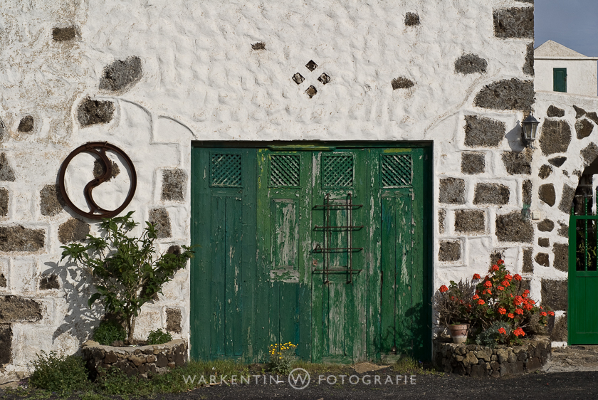
The neighboring villages of Yaiza and Uga in the southern part of Lanzarotes are worth a photo excursion, like Teguise, the old island capital, with its picturesque streets, traditional houses and old churches. However, the market, which has been advertised many times on Sundays, has nothing in common with the traditional farmers’ market. Tourist-Nepp and -Kitsch dominates the street scene everywhere, so you should get to know the place better on another weekday. After the memory cards are full and the feet are tired, a visit to one of the Bodegas is worth it, there is next to a cool beer (Un Cerveca, por favor!) Or wine (Un coppa di viño, por favor!) Many delicious tapas , Which should not be missed in his Lanzarote holiday.
The north and La Graciosa
Anyone planning an excursion to the north of the island to Orzola should get up early. The distance of about 60 kilometers offers a variety of sights and photographs, so that one does not progress as fast as one expects. A particularly photogenic place is “Haria” in the “valley of the thousand palm trees” with its somewhat African oasis flair. The cactus garden designed by the famous artist Cesar Manrique, the underground lagoon called “Jameos del Agua” and the lava cave “Cueva de los Verdes” with their imposing lava caves are also worth a visit. If you want to use the port of Orzola as a starting point for a boat trip to the small neighboring island of “La Graciosa”, you should definitely not do it on your last day of your holiday, because it can happen that the return trip to the next day is delayed. Only bad tongues claim that the captains want to support the family pensions in “La Graciosa”. “La Graciosa” itself offers besides a few buildings pure nature. Since there are no roads, one can only walk on the sandy island by foot. Extensive but somewhat tedious hikes to partly wild-romantic coastal sections are so possible.
Papagayo beach
Not to be missed is the famous “Papagayo Beach”. It is the largest beach with white sand, swayed from the Sahara on the island, and the postcard photos are rarely human, even though it is a little secluded, only on rough and feeble slopes in the southeast of the island.
The Canary Island of Lanzarote offers not only year-round a pleasant climate, but also many interesting and some very spectacular photographs. Only for beach tourists the island is certainly not the first choice.